


Egypt
– Wadi el Gemal and the Red Sea –
Egypt – Wadi el Gemal and the Red Sea
Egypt reveals a surprisingly quiet, unspoiled side in the south. Far from the famous pyramids, ecologically diverse desert landscapes and protected natural areas shape the region. Our impressions come from the area around Marsa Alam and Wadi el Gemal National Park, where the Eastern Desert meets the Red Sea. We were particularly moved by the warm hospitality of the Ababda and their deeply rooted respect for nature.

- Pure Nature
- Wadi el Gemal – Valley of the Camels
- Red Sea – Formation and Characteristics
- The Northernmost Coral Reefs in the World
- Ababda Bedouins
Pure Nature
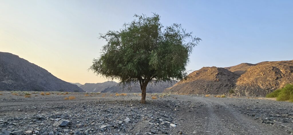
Away from Egypt’s classic holiday regions, we deliberately set out on the long journey into the silence of Wadi el Gemal National Park, south of Marsa Alam. We visited once in August and once in November – each stay had its own distinct appeal. The light changed the atmosphere, different animals appeared, seasonal plants shaped the landscape, and each time of year opened up new activities. Exploring the desert by bicycle, for example, would not have been possible in the August heat. Yet the downsides also became apparent: within just two years, we observed noticeable changes to the house reefs of the Shams Alam and Gorgonia Beach resorts.
Wadi el Gemal – Valley of the Camels
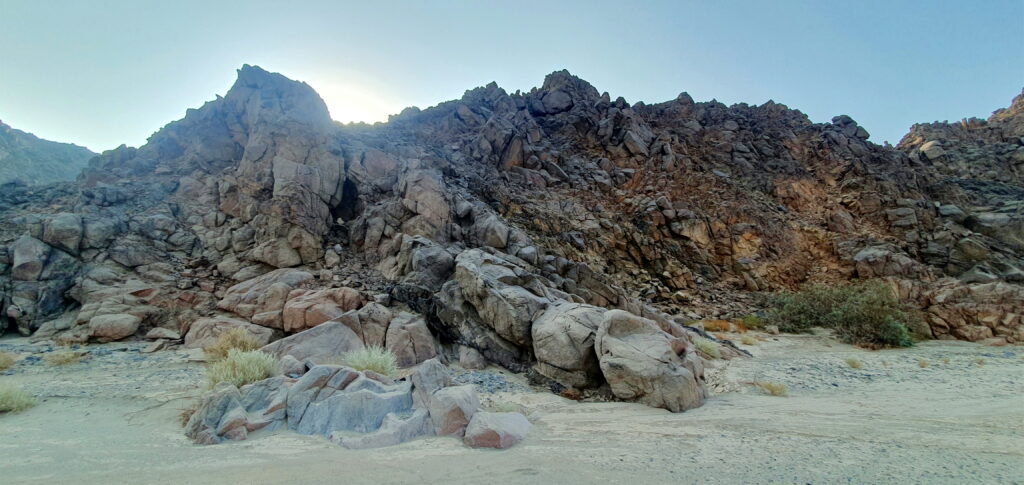
Wadi el Gemal is still one of Egypt’s lesser-known and less-visited regions. Translated from Arabic, the name means “Valley of the Camels” and only begins to hint at the extraordinary diversity of this area. Owing to its numerous ecosystems, striking natural landscapes, and significant archaeological sites – including the world’s oldest known emerald mines – Wadi el Gemal is regarded as one of the country’s most fascinating regions.
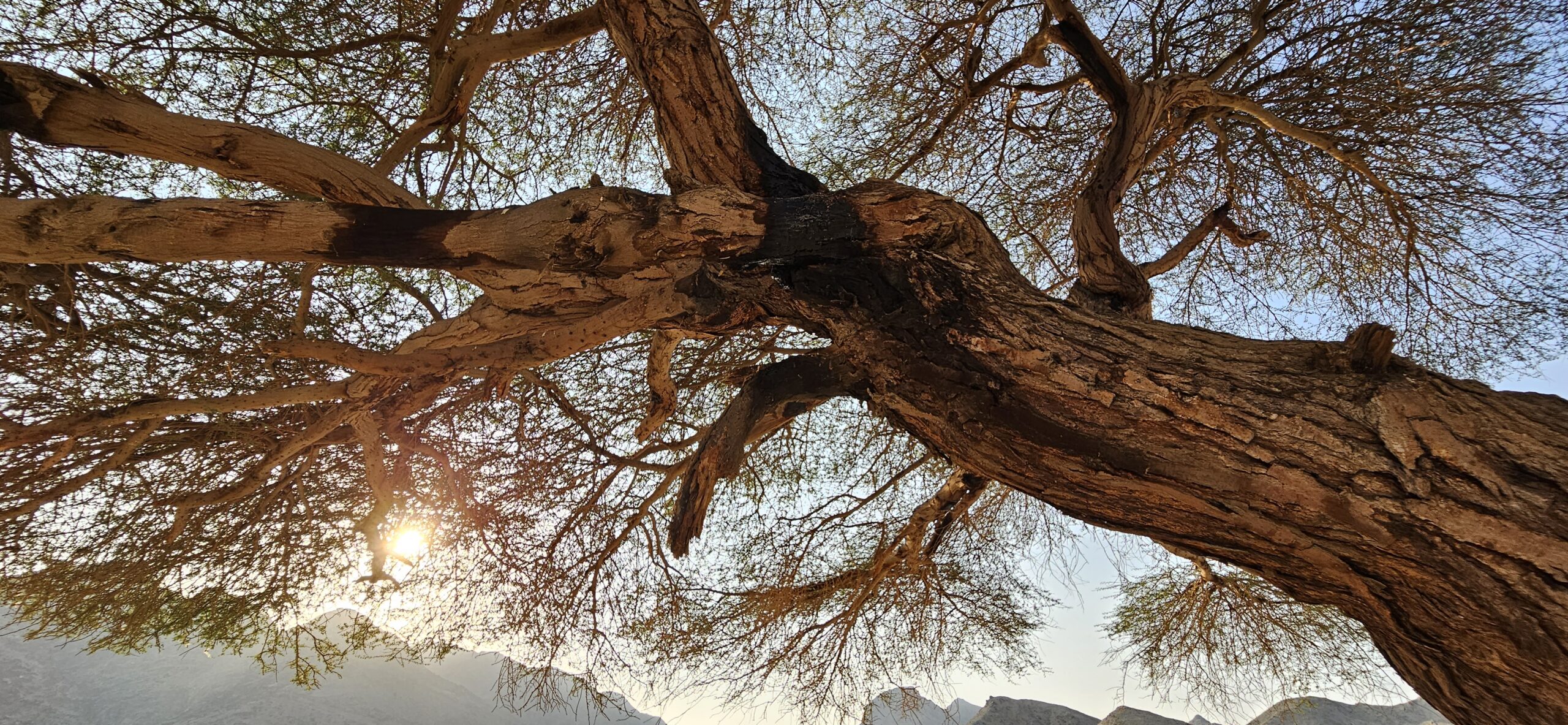
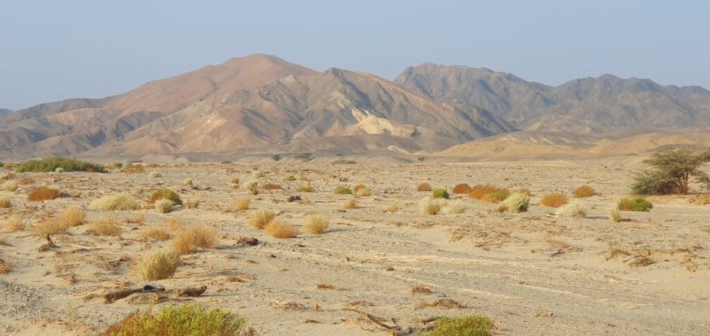
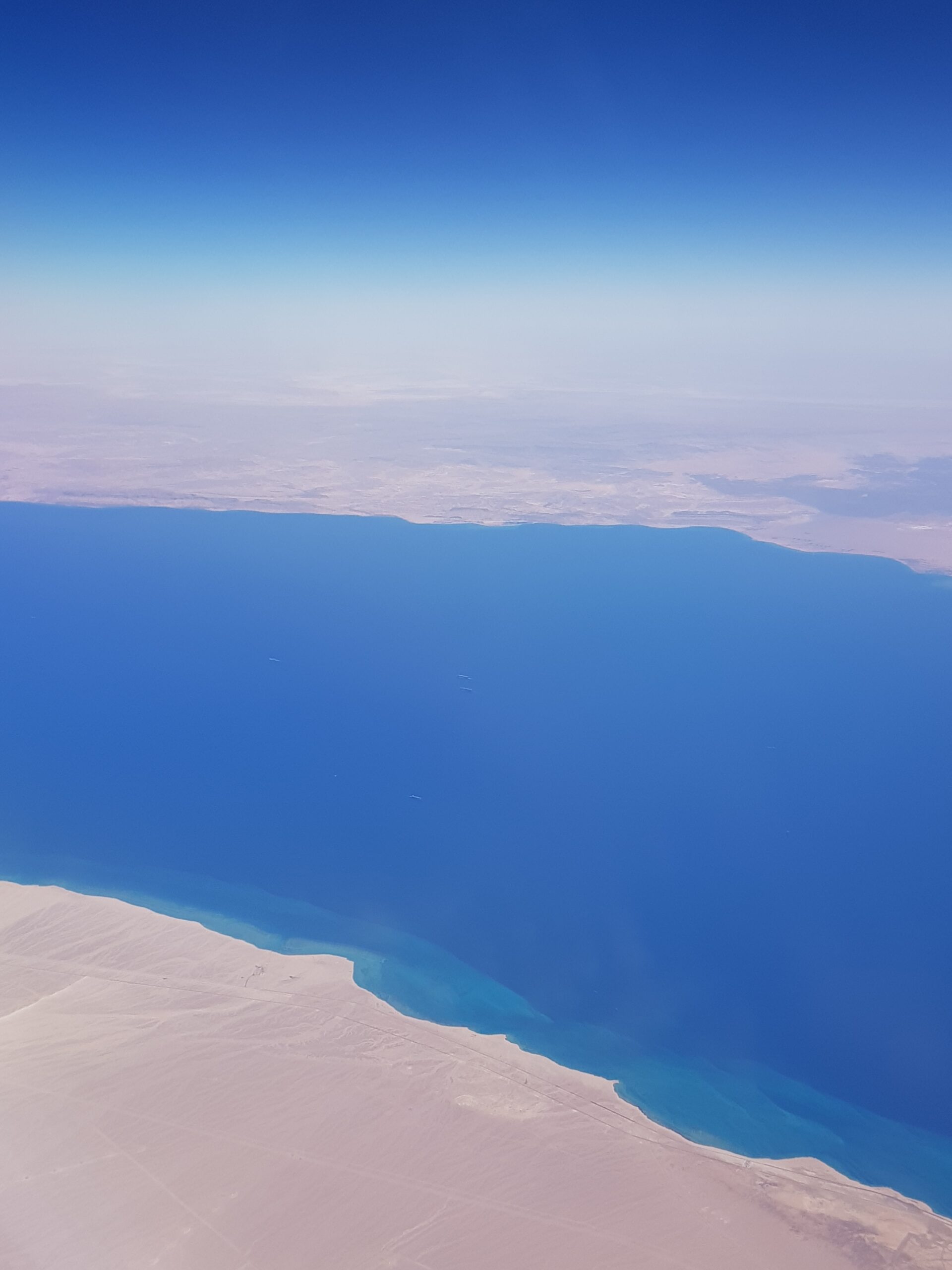
Wadi el Gemal lies around 45 kilometers south of Marsa Alam and is one of the largest valleys of the Eastern Desert – the Egyptian part of the Arabian Desert between the Nile Valley and the Red Sea. From a geological perspective, it is the dried-up riverbed of a once powerful river that originated in the western high mountain ranges around 15,000 years ago. Its source was at Gebel Hamata, the highest mountain in the region at 1,975 meters. Fed by around 20 tributaries, the river formed a wide-ranging network of side valleys before eventually flowing into the Red Sea.
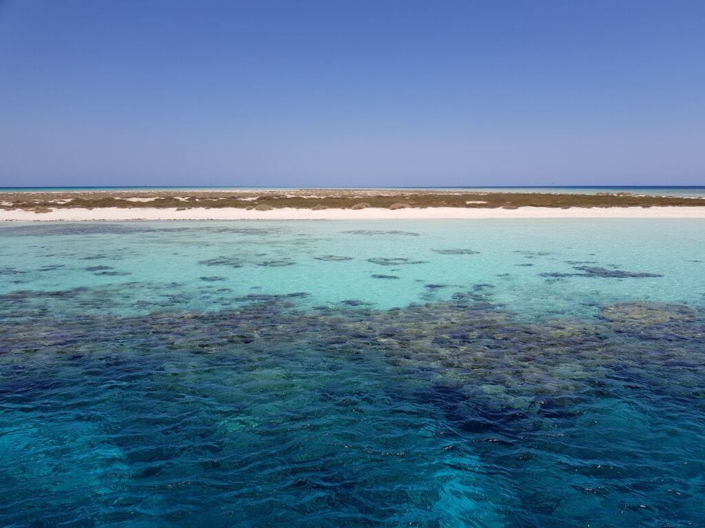
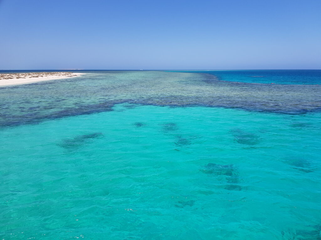
Due to its exceptional ecological and scenic significance, Wadi el Gemal was designated a national park in 2003. The protected area covers approximately 4,770 square kilometers of land as well as around 2,000 square kilometers of marine territory. Along the roughly 120-kilometer coastline, species-rich mangrove forests extend, often bordering directly on offshore coral reefs – an interplay of desert and marine ecosystems that is rare in Egypt.
Red Sea – Formation and Characteristics
The Red Sea was formed by the separation of the African and Arabian tectonic plates, which created a deep rift valley stretching from the Jordan Valley to East Africa. Even today, the plates continue to drift apart, causing the sea to become slightly wider each year.
Its shape reflects this origin: narrow, elongated, and deep. It stretches for more than 2,200 kilometers, is typically between 250 and 350 kilometers wide, and reaches depths of over three kilometers. At its southern end, it narrows to just under 30 kilometers and is only about 130 meters deep. As a result, only a limited amount of water from the Indian Ocean enters the Red Sea.
The Red Sea lies amid vast desert regions, which results in particularly high evaporation rates. It is also the only sea in the world into which no rivers with a year-round flow discharge. Only wadis – dry valleys that carry water briefly after prolonged rainfall – bring small amounts of freshwater into the sea. These conditions lead to an exceptionally high salinity of up to 42 per mille and to extraordinarily clear water with great visibility, as very few nutrients or sediments – tiny particles of rock or organic material that rivers normally transport and deposit – enter the sea.
Why is it actually called the “Red Sea”?
Anyone standing on the Red Sea for the first time is often surprised: the water shimmers in turquoise, blue, or deep blue – but certainly not red. So where does this evocative name come from?
The answer leads far back into antiquity and has less to do with the actual color of the water than one might initially assume. While there are theories that refer to occasional blooms of red algae or to the reddish hues of the surrounding desert mountains, these explanations are now generally regarded as retrospective interpretations.
A more plausible explanation is that the Red Sea owes its name to the way people organized the world over 2,000 years ago. The term “Red Sea” most likely derives from an ancient system of directional designations. In several cultures of the Ancient Near East – including the Babylonians, Assyrians, and likely also across the wider Mediterranean region – cardinal directions were associated with colors:
- Black stood for the north (cold, darkness)
- White for the west (the direction of sunset, symbolically associated with transition and the afterlife)
- Blue or green for the east (the direction of sunrise, symbolically associated with life and renewal)
- Red for the south (heat, sun)
From this perspective, the Red Sea was simply the “southern sea“, named from the viewpoint of the ancient high cultures of the eastern Mediterranean. The name was therefore geographical in meaning, not visual. It is a fine example of how ancient ways of thinking, symbols, and worldviews continue to shape our present day – often without us being consciously aware of it.
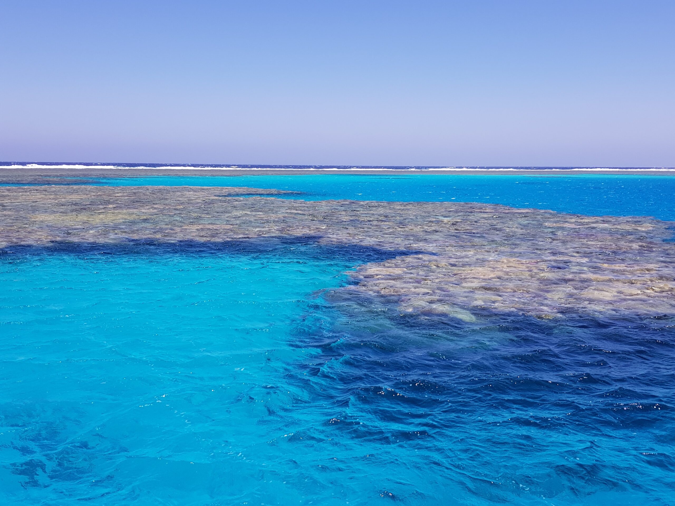
The Northernmost Coral Reefs in the World
The Red Sea is home to some of the northernmost coral reefs in the world, alongside a few reefs in southern Japan. For corals to thrive, water temperatures must not fall below 20 degrees Celsius even in the coldest month. Persistent winds along the Red Sea ensure continuous water circulation, so that comparatively warm temperatures prevail even at depths of more than 1,000 meters.
Characteristic of the Red Sea are the massive fringing reefs that run a few meters to several kilometers offshore and drop off steeply. In addition, there are isolated coral reefs that lie flat in the sea or rise up from great depths, such as the well-known Elphinstone Reef.
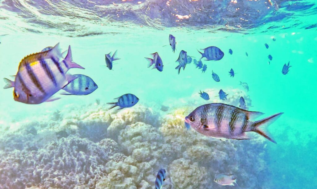
Beyond the sandy shores of Wadi el Gemal stretches an impressive coral reef with several formations running parallel to the coast. It is home to more than 100 fish species as well as marine mammals such as dolphins and dugongs, and is still in relatively good condition – yet changes are already noticeable, especially near the coast.
Due to the length of the Red Sea, the distribution of individual species is often uneven: species that are common in the south occur only rarely or not at all in the north, while other species show exactly the opposite pattern.
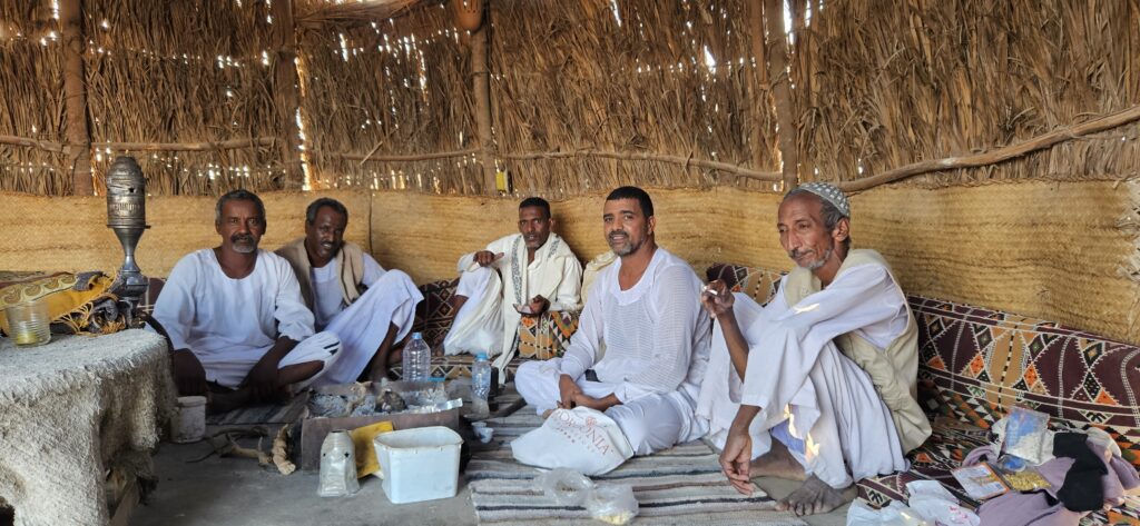
Ababda Bedouins
Wadi el Gemal is not only a habitat for an astonishing diversity of plants and animals, but also the homeland of a people who have been rooted in this region for centuries and are closely connected to it: the Ababda, also known as the Ababda Bedouins. Bedouins are traditionally nomadic or semi-nomadic peoples who primarily inhabit the deserts of the Middle East and North Africa. Today, several thousand members of this community live in and around the national park.
The Ababda are regarded as exceptional experts on Egypt’s Eastern Desert. Their knowledge of water sources, animal migrations, plants, and ancient caravan routes is an essential part of the cultural heritage of this landscape.
Leave a Reply